British Columbia Travel GuideThe unofficial BC Travel & Tourism Guide


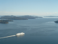
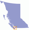
Pender Island, positioned in the Georgia Strait, is actually two islands. The original island was separated into two halves, Pender Island South and Pender Island North, in 1955. A deep man-made canal was dug as a transportation channel for the ferry service and designed to cut the route at a narrow point of the island to shorten the trip around the southern end. Today, visitors journey to either end by way of a short one lane (automobile) bridge. South Pender contains plenty of forest, park land, and mountainous areas to explore, whereas North Pender plays home to most of the residents, artists and community needs blending harmoniously with nature. The two islands of Pender Island are home to largest combined volume of inhabitance in the Southern Gulf Islands along British Columbia’s West Coast. The islands are easily accessible by ferry, float plane or personal water craft. (Nearest major ports and ferry terminals, Vancouver –Tsawwassen, Victoria – Swartz Bay and Saltspring Island). Discover more details for Pender Island North and Pender Island South below.
Pender Island Accommodations
Pender Island Things to Do